


Revisiting the Solar Path of the Inca Creator God
The high priests of the Inca Empire of ancient Peru used their sacred texts, known as the Codes of Sacred Geography, to build sacred community centers (wakas) along 42 long-distance ceque lines. These alignments were all centralized at the Coricancha (Qorikancha) Temple of the Sun in Cuzco, where a huge golden disc at the center of this temple radiated these lines across the entire Inca empire.
The Inca creator god Viracocha undertook a legendary journey from the city of Tiwanaku on the shores of Lake Titicaca and crossed mountain peaks, towards the north-west, where he left the shore of South America’s Pacific coast near the border of Peru and Ecuador.
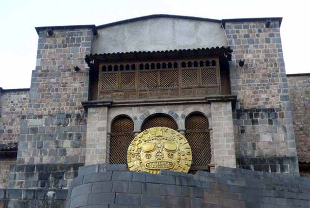
Replica of the Golden Sun Disk on display outside the Coricancha Temple, used in modern day festivals in Cuzco. (Image: Ashley Cowie)
Ancient Landscape Alignments – the Concept of Ley-lines
In the summer of 1921, amateur archaeologist Alfred Watkins, stood on a hillside in Herefordshire, England, and noticed a straight line of churches, town crosses, and ancient burial mounds and in 1925 he published The Old Straight Track postulating that the entire English countryside was knitted together with similar alignments. Clive Ruggles is the United Kingdom’s leading authority on archeoastronomy and in his Ancient Astronomy: An Encyclopaedia Of Cosmologies and Myth, (2005) he noted that the alignments of the buildings Watkins plotted, had place names containing the syllable ‘ley,’ hence the term ‘ley-line.’
At the time, and generally still today, archaeologists mostly disregarded Watkin’s theory if for no other reason than ancient Britons were regarded as being “too primitive” to have devised a system where buildings are located along ancient landscape alignments. Nowadays, the skeptical argument is one of probability: since so many ancient features pepper the English countryside, the chances of finding alignments is quite high.
- The Golden Stick: Cuzco’s Divine Foundation Myth and The Scientific Connections
- Rediscovering the Lost Code of the Inca Cosmic Power Matrix
- Revisiting The Oracle Of Pachacamac In Peru
A catastrophic mess of alignments can now be found on the internet and often they are given ‘ancient alien’ origins; and perhaps Watkins would turn in his grave if he knew what the New Age has done with his observations. This sentiment was shared in 2004 by John Bruno Hare of the Internet Sacred Texts Archive (ISTA) who wrote a paragraph in Early British Trackways in defense of Watkins: “He was an intensely rational person with an active intellect, and I think he would be a bit disappointed with some of the fringe aspects of ley-lines today.”
Differentiating between Practical Alignments and Mystical Lines
Today, we have two distinct types of alignment researchers. On the one hand are professors of archeoastronomy like Clive Ruggles in England and J. D. Morales in Colombia. These academics understand how difficult it is to interpret the minutia of ancient structures, and having to account for how movement causes misalignment over time, they have to adhere to strict academic practices, taking in account a multitude of environmental variables and restrictions and then draw cultural conclusions as to why an alignment might have been executed.
On the other hand, there are the sensationalist authors who, with predetermined conclusions, often harness a sacred alignment to support an already weak theory. They blast felt tips on flattened world maps, caring little that such crudities might represent distances of several miles on the actual landscape.
While British archaeologists have traditionally had reservations when assigning even the most rudimentary surveying skills to their ancient cultures, scientists in other countries have a rich understanding of how their indigenous cultures not only created localized alignments linking temples and shrines with natural features, but also how they extended long-distance alignments over hundreds of miles in length, uniting sacred sites across entire territories. In many countries in South America, 16th century Spanish chroniclers recorded the lengths of staffs and types of wood chosen, by indigenous surveyors to extend their alignments.
