

Remnants Of Roman Roads And Fortresses In Scotland
The Romans occupied what is today Britain between the late first to mid-fifth centuries. To move their legions from one place to another, they built over pre-existing trackways to form the foundations for the Roman road system that would enable quick transport of troops and equipment. In England, examples of Roman roads include the Ridgeway and its parallel lower neighbor, the Icknield Way, and perhaps most well-known is Mastiles Lane. The latter Roman marching road near Malham and Kilnsey in North Yorkshire later became the Old Monks' Road along which Cistercian monks transported sheep from Fountains Abbey to summer pastures on higher ground. According to Walking Englishman between 1536 and 1541 King Henry VIII disbanded monasteries, priories, convents, and friaries in England, Wales, and Ireland, and after the so-called dissolution of the monasteries it is thought Mastiles Lane became a drove route for cattle being brought to England from Scotland, and today it serves as a popular Dales walking trail.
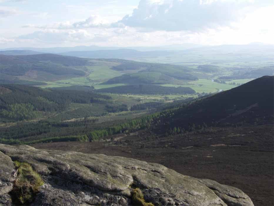
Rural Aberdeenshire, looking from the heights of Bennachie towards the lower-lying land in which Roman camps were situated (CC BY-SA 3.0)
Roman Invasion of Scotland
In 79 AD, under General Agricola, the Romans invaded Scotland and advanced as far as the River Tay, which, originating in western Scotland on the slopes of Ben Lui, is the longest river in Scotland and the seventh-longest in Great Britain. Attempting to colonize the north of Scotland, which they ultimately failed in, the Romans did manage to build a vast network of roads linking their marching camps, forts, watchtowers and beacons. While the main Roman roads in Scotland are well known and were used for hundreds of years after the invaders retreated, many were quickly built and sometimes quicker abandoned, leaving something of an archaeological jigsaw puzzle across Scotland. However, it is known that almost all Roman roads in Scotland follow the courses of pre-Roman native roads, which generally followed more accessible and easier to defend higher ground, along the tops of hill ridge systems.
In 80 AD the first Roman forts were built along the Clyde-Forth line and in 81 AD Agricola moved his troops into the west and southwest of Scotland from where he intended to create an invasion route along the west coast, as well as a point from where to launch an invasion of Ireland. The following year the Romans marched northwards up the east coast of Scotland fighting off persistent guerilla attacks by the indigenous forces of Scotland, whom they faced off at the Battle of Mons Graupius. In the 19th century historians associated the Battle of Mons Graupius with almost every Roman site in Perth and Kinross in Central Scotland, but after the emergence of aerial photography in the 20th century, a series of marching camps en route to the Moray coast were identified. Modern research suggests this battle occurred in Aberdeenshire at the foot of Bennachie Hill, just south of a large Roman marching camp which was discovered at Logie Durno.
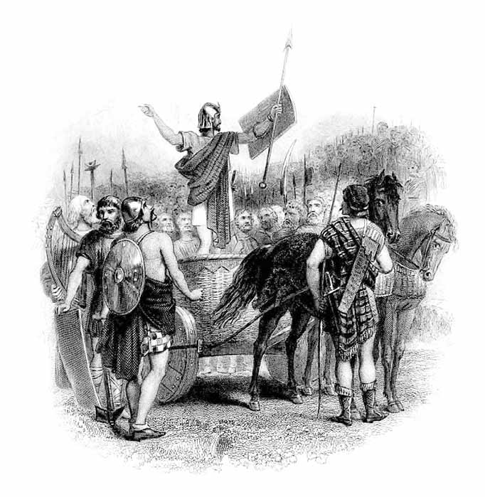
Steel engraving of a sketch depicting the speech of Calgacus before the Caledonians at the Battle of Mons Graupius (Public Domain)
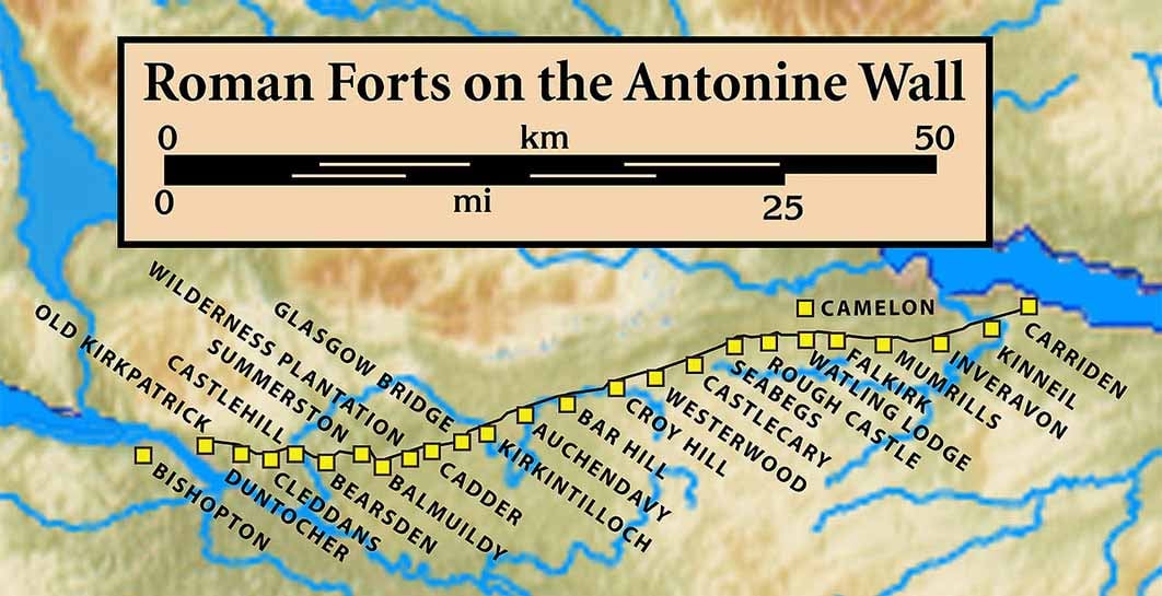
After this famous battle Roman troops were transferred from Britain to the Balkans and the remaining Romans in Britain retreated south to the Tyne-Solway line. In 142 AD (the Antonine period) the Romans pushed north again to the front line of the Clyde and Forth where they built the Antonine Wall and rebuilt Loudoun Fort. In the 160s AD the Romans again retreated south to Hadrian’s Wall leaving some of their forts in the southwest occupied with soldiers. But how exactly did thousands of Romans soldiers penetrate so deep into northern Scotland?
Roman Forts in the Far North
To access Scotland from England, the Romans built three main arteries: in the east at Pennymuir near the modern A68, in the west connecting Carlisle and Lockerbie, near the modern M74 and via the Tweed at Tweedmouth. However, a fourth route is suspected where the old bridge is located in Berwick. According to a recent episode on the Scottish Roads Podcast from Lanark, this Roman road traces north towards Cumbernauld with a likely destination of Castlecary or Croy Fort on Antonine’s Wall, which was known to the Romans as Vallum Antonini, ranging between the Firth of Clyde and the Firth of Forth.