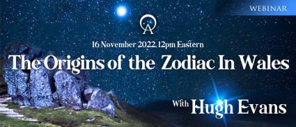
The Star Maps of Gwynedd, covers the entire north-west quarter of Wales, and is considered the largest distinct ancient site on Earth, with over 2,000 square miles incorporating thousands of named stone circles, cairns, standing stones, mountains, rivers, sacred sites, holy springs, churches, towns and even public houses. In comparison, the greater Stonehenge area covers 200 square miles, and the ancient Egyptian sites including Giza, Saqqara, Dendera, Abydos and Luxor cover about 400 square miles, as does a square area from Gōbekli Tepe to Karahan Tepe to the ancient star city Harran.
British mythology recounts that the stars were mapped from the top of the central, sacred mountain Cadair Idris in Northern Wales, by the Great Astronomer Idrisi. Idris was also known as Enoch, and he was the great grandfather of Noah, dating the star maps to approximately 4500 BC.
At Gōbekli Tepe – and many other megalithic sites - archaeo-astrologists are discovering that the ancients demonstrated their knowledge of astrology by aligning structures with the stars and leaving cryptic messages in the reliefs. Gōbekli Tepe has been radiocarbon-14- dated from 9500 BC (enclosure D) to 7500 BC (enclosure C). If Pillar 43 of Enclosure D is a representation of the constellations and the constellations were fixed in Gwynedd, then the Star Maps of Gwynedd may be much older than Gōbekli Tepe.
Hugh Evans indicates how the Zodiac constellations could have been mapped out during the antediluvian era as certain megalithic sites in north-west Wales seem to correspond with the 12 constellations and ancient Welsh explains key elements.
[[{"type":"media","view_mode":"media_original","fid":"21646","attributes":{"alt":"","class":"media-image","height":"200","style":"width: 200px; height: 200px; float: left; margin: 5px;","typeof":"foaf:Image","width":"200"}}]]
Hugh Evans studied Astrophysics at university, graduated in aeronautical engineering, subsequently qualifying as a Chartered Accountant. He now applies his scientific interest, engineering rigour and professional scrutiny to a lifelong passion for history and the stars; offering a new perspective and rediscovering the story of the ancients.
Hugh has invested thousands of hours of painstaking research, site visits, hieroglyph interpretation and language translation to identify all the features of the present zodiac and circumpolar constellations across the land features of Gwynedd, North Wales. Thousands of years older than the Babylonian and Egyptian zodiacs, perhaps even older than Gōbekli Tepe, the features on the ground in North Wales actually determined the choice of stars for the constellations in the heavens above. He is the author of The Origins of the Zodiac, Cadair Idris and the Star Maps of Gwynedd.
