

Archaeo-astronomy Of The Ancient Nabataeans In Petra
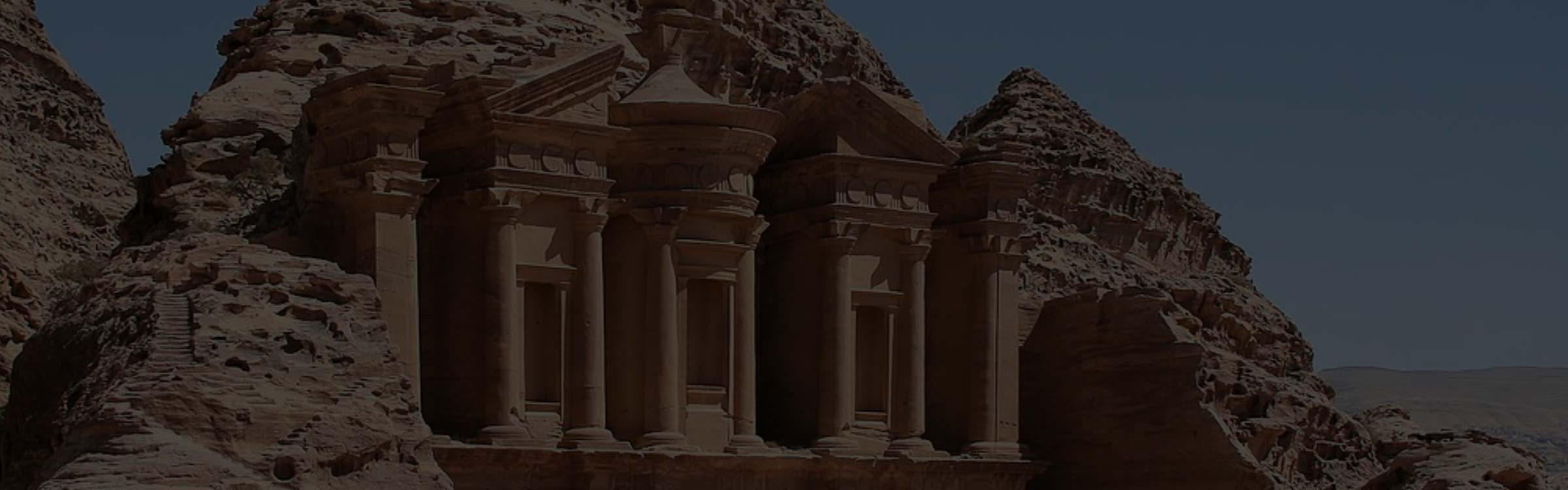
Adoration of the Sun and alignment of monuments to its annual path through the skies was universal in the ancient world. Evidence of that devotion has been uncovered in sacred architecture across hundreds of years and thousands of miles. The Sun is the crucial source of life and light; early cultures honored the Sun through their manifestations of divinities who represented the Sun, such as Ra, Atum, Apollo, Kinich Ahau, Huitzilopochtli, and Inti to name just a few. In the ancient, long-hidden city of Petra, their Sun god was called Dushara. The settlements around Petra thrived for almost a thousand years. For many centuries the city prospered as a lively caravan hub situated between the Red Sea and the Dead Sea. The ancient city of Petra was built by the Nabataeans, formerly a nomadic Arabic tribe of the desert, who settled in this mountainous terrain. They gained mastery over the arid, formidable landscape, rocky cliffs and scant natural resources. Their superior knowledge and successful culture are abundantly displayed in the colorful city’s beautiful art and architecture.
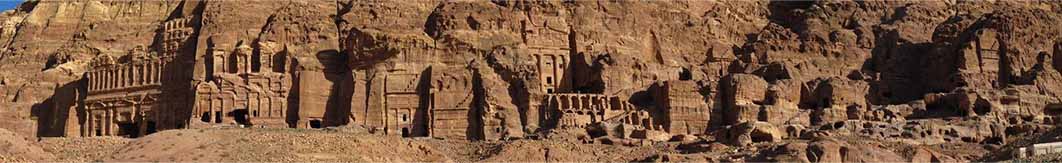
Tombs in the southern part of Petra (CC BY-SA 3.0)
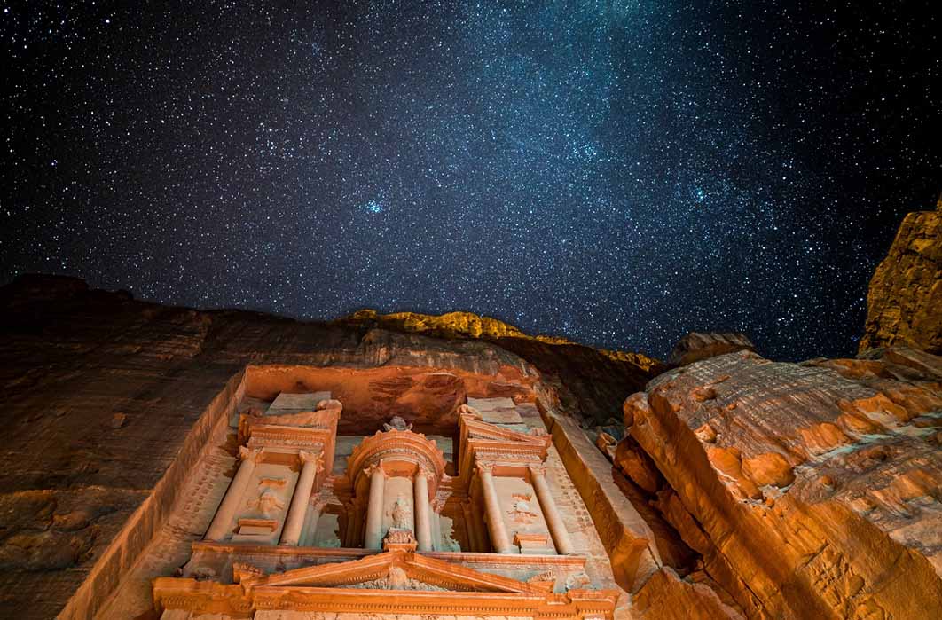
After various excavations, the city of Petra was discovered to contain more than 3,000 temples, tombs, and monuments along with thousands of caves, all astonishingly carved out of the vast area of sandstone rockface. Surprisingly, only 15 percent of the fabled city has been uncovered as yet. Through advanced research techniques archaeo-astronomers have rediscovered the Nabataeans’ extensive understanding of astronomy and their devotion to the heavenly gods. They applied their knowledge of the heavens when designing and constructing not only their incredible city of Petra, but also other towns throughout their expansive Nabataean Kingdom.
Recent archaeological investigations and the use of GIS- generated horizon diagrams (geographic information system) by archaeo-astronomers have demonstrated that many of the carved, cave-like buildings, as well as the stone-constructed buildings, were purposely orientated to significant positions of the Sun. Scientists have measured 50 sacred precincts throughout the city. The buildings and shrines investigated show numerous alignments to astral bodies, mainly the Sun and the Moon. In fact, they estimated that 70 percent of Petra’s structures have specific alignments to the Sun on days of the solstices and equinoxes as shown in the extensive study by archaeologist Jean Antonio Belmonte and his colleagues. These structural alignments were definitely not established by chance but were an integral part of a deliberate cosmologically-designed plan by their astronomer/priests.
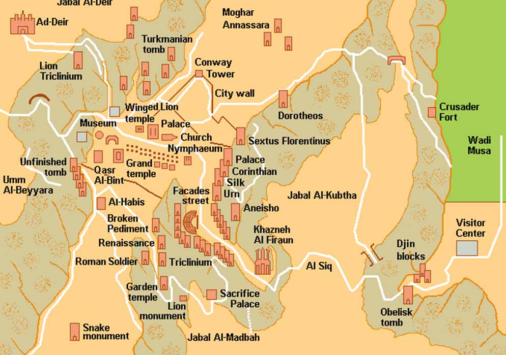
Map of Petra (Public Domain)
Petra’s location within the harsh, barren desert of southern Jordan was transformed into a well-watered oasis for caravans traveling the spice routes between important trading centers. The Nabataean city sits at the very edge of the Hellenistic world, but its resources and wealth brought by the traveling merchants from India and the exotic Far East allowed the city to prosper and become a major trading center that thrived for over 500 years. Craftsmen of Petra became highly-skilled in water-management, able to provide plentiful supplies of water for their residents and for travelers, making the city a prime destination for successful trading opportunities.
Caravans transporting valuable silks, carpets and precious spices, particularly frankincense and myrrh, passed through the rock-red city; travelers rested while purchasing food and supplies, and they paid fees. The Nabataeans’ control over these trading routes lasted from the first century BC until 104 AD when Emperor Trajan designated Petra as a part of the Roman province of Arabia. Rome was anxious for a share of their plentiful profits; in turn, Petra needed their protection along the long, unguarded desert trails. To protect the cities and caravans from marauding nomadic tribes, Romans built military camps and laid a new road called Traiana through the country to transport trade goods from the Red Sea to the Mediterranean more safely. Petra’s territories and lucrative trade routes were well maintained until 363 AD when an earthquake greatly damaged not only many important buildings but also the city’s crucial water system, but the city managed to survive through Late Antiquity.