

Shifting Earth Crusts: Does the Ancient Piri Reis Map Pinpoint Atlantis?
A master’s degree post graduate from Harvard University, Charles Hapgood served on what would eventually become the U.S. Central Intelligence Agency and was a liaison officer between the White House and the Secretary of War. He wrote a book about earth crustal displacement - that featured a Forward written by Albert Einstein - and possessed an open, inquiring mind that was suspect to mainstream academia. His Wikipedia biography says his ideas: "were never accepted as valid competing scientific hypotheses, yet [they] have found popularity in alternative circles."
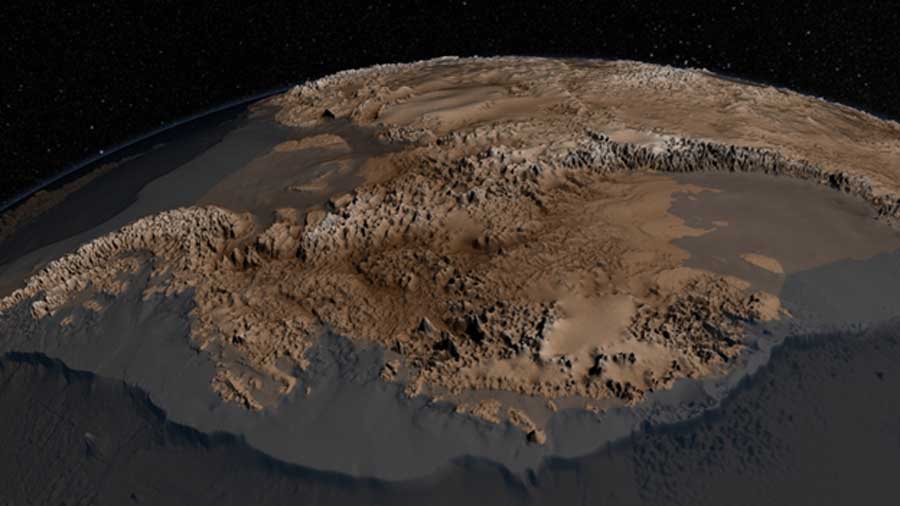
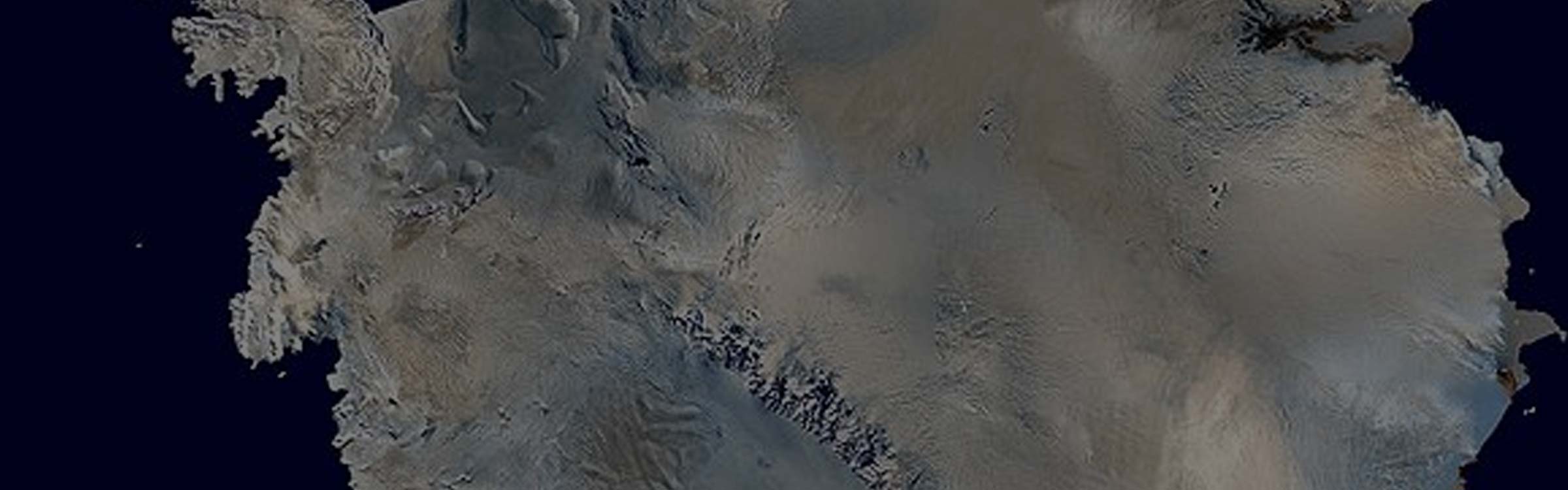
The bedrock topography of Antarctica, critical to understand dynamic motion of the continental ice sheets (NASA/Public Domain)
Continental Drifts Abound
While a professor at Springfield College, one of his students asked a question concerning the lost continent of Mu. He welcomed such inquires and used the question as a springboard to talk about his Atlantis theory. When the class responded favorably, he decided to investigate the possibility of a historical catastrophe that might have occurred within the span of human life on the planet. By 1958 he had learned enough to write a book called The Earth's Shifting Crust. That was the book that eventually caught the attention of Albert Einstein. In it Hapgood questioned the theory of continental drift and instead proposed that at various times in the past the entire surface of the earth had shifted: "just as the peel of an orange might shift around the orange itself."
One of his arguments concerned the existence of ancient maps that show a world quite different from the one we know today. In 1966 he wrote Maps of the Ancient Sea Kings: Evidence of Advanced Civilization in the Ice Age, which he followed in 1968 with The Path of the Pole. The crux of Hapgood's argument is based on a series of maps that, at the very least, raise some interesting questions. One of them is called the Piri Reis map.
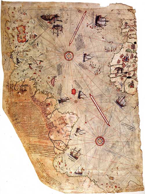
Surviving fragment of the Piri Reis map showing the Central and South American coast. The appended notes say "the map of the western lands drawn by Columbus” (Public Domain)
The Piri Reis Map
Piri Reis was a Turkish admiral who lived between 1470 and 1554. Born in Gallipoli, which was a naval base of the Marmara Sea, he was a son of the pirate Kemal Reis, who somehow had reinvented himself as an admiral. In those days, such things were a lot easier than today. The two sailed together from 1487 to 1493. This was when Piri learned the art of naval warfare.
Book on Navigation by Piri Reis (circa 1467 – circa 1554 )(Walters Art Museum) (Public Domain)
