

Astrophysics - The Origins Of The Zodiac In Wales
Astrophysics indicate the origin of the Zodiac may just be found within the Star Maps of Gwynedd, one of several counties or administrative districts in North Wales. Thousands of years ago Gwynedd was an ancient kingdom in its own right, covering the entire north-west quarter of Wales. The Island of Anglesey (original name Ynys Mons), fabled home of the Druids, was also part of ancient Gwynedd.
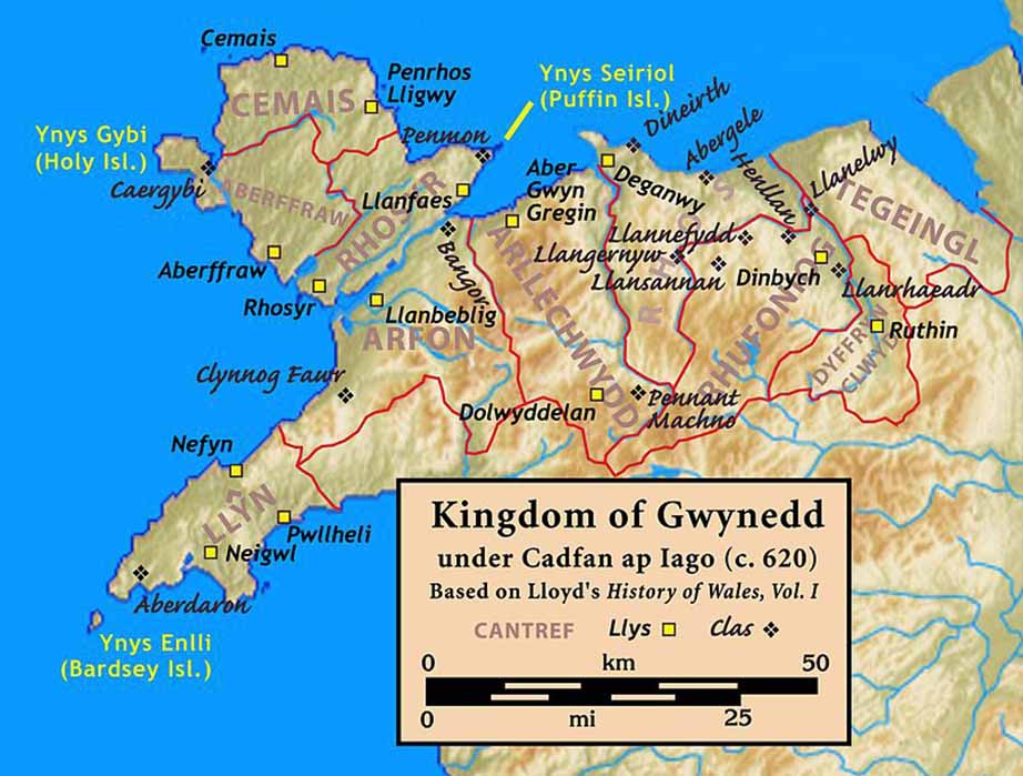
Kingdom of Gwynedd c. 620 (CC BY-SA 3.0)
The Star Maps of Gwynedd may be the largest distinct ancient site on Earth covering 2,000 square miles (5,179 square kilometers) or 1,000,000 acres. In comparison, the greater Stonehenge area covers 200 square miles (517 square kilometers)and the ancient Egyptian sites including Giza, Saqqara, Dendera, Abydos and Luxor cover about 400 square miles (1,036 square kilometers), as does a square area from Gōbekli Tepe to Karahan Tepe to the ancient star city Harran.
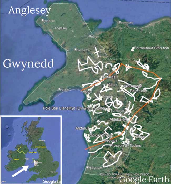
Star Map area of North Wales. (Image courtesy ©Hugh Evans)
The Star Maps of Gwynedd are anything from 4,500 to 6,500 years old, perhaps much older, incorporating thousands of named stone circles, cairns, standing stones, mountains, rivers, sacred sites, holy springs, churches, towns and even public houses. CADW (Welsh heritage) date the stone circles as to the Bronze Age circa 2500 BC, but the star maps demonstrate an understanding of the stars that goes back thousands of years earlier. British mythology recounts that the stars were mapped from the top of the central, sacred mountain Cadair Idris by the Great Astronomer Idris. Idris was also known as Enoch, and he was great grandfather of Noah, dating the star maps to approximately 4500 BC. The Book of Enoch says that Enoch was instructed by Uriel, who was already there!
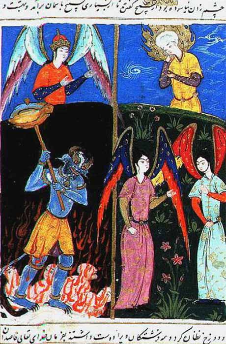
Idris looking at the hell after his ascend to the heavens (Public Domain)
In comparison, the Stonehenge area is now thought to be circa 3250 BC, although some Mesolithic post holes have been dated at circa 8000 BC. The ancient Egyptian sites date from circa 3500 BC to 100 BC, some say they are older. And Gōbekli Tepe has been radiocarbon 14 dated from 9500 BC (enclosure D) to 7500 BC (enclosure C). If Pillar 43 of Enclosure D is a representation of the constellations and the constellations were fixed in Gwynedd, then the Star Maps of Gwynedd may be older than Gōbekli Tepe. It seems simpler and less effort to reproduce a pillar from a star map that covers 1,000,000 acres, than the other way around. It is possible that the constellations were conceived in fragments or stages in many places over time, and then brought together by a common people to Gwynedd. The constellations recognized today such as The Plough, changed their shape over a precessionary cycle, and the constellations require remapping periodically.
