

16th-Century Maps Reveal 1800 BC Ice Free Greenland And Antarctica
There is a large body of maps of the Americas which cannot be explained by known explorations. Mercator’s 1569 World Map shows all of Greenland without ice at its coasts. Finaeus’ 1531 World Map shows Antarctica without coastal ice, all Greenland without coastal ice and an ancient shoreline of Hudson Bay. No 16th-century explorer could have reached Antarctica and Northern Greenland during this time period, much less have seen them ice free at their coasts. Based on an analysis of historic rates of isostatic rebound in lower James Bay, it appears that the ancient surveys for these maps of Antarctica and Northern Greenland were made approximately 3,700 years ago, and that global warming following the last Ice Age was sufficient to result in the coasts of Antarctica and Greenland being ice free by 3,700 years ago.
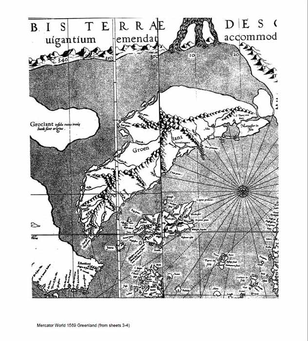
Detail of Greenland of the 1569 Mercator World Map (Deriv: Author Public Domain)
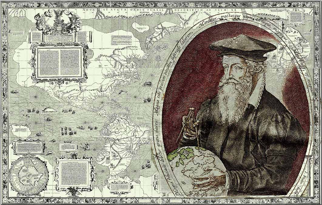
Gerard Mercator states in the North American section of his 1569 World Map: “The third aim that we had in view was to show what parts of the world were known to the ancients and to what extent, in order that the limits of ancient geography may not be unknown and that due honor may be paid to the earlier ages.” He then continues, after citing voyages mentioned by Pliny and Herodotus: “It is clear, then, that our continent is surrounded by the ocean, and that its extent was known to the ancients; and it is evident on their authority that it was in large part described. Plainly those persons are mistaken who make New India continuous with Asia.” (Feit, 1926).
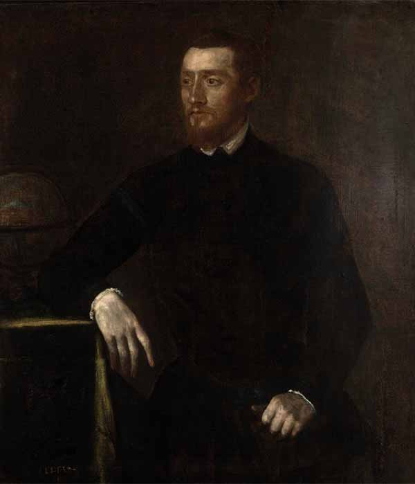
Workshop of Titian - Gerard Mercator (ca. 1550) (CC BY-SA 4.0)
The words “our continent” refer to both North and South America, which are labeled on Mercator’s map “India Nova” or New India in the translation. And, based on this ancient knowledge, Mercator recognizes that North America was not part of Asia. Supporting Mercator’s statement are many well-known 16th-century maps of the Americas which cannot be explained as resulting from any known exploration by Europeans. Some notable examples are: the Waldseemuller World Map, 1507, and the Lenox Globe, 1510, showing the West coast of South America. Balboa, the first European to see the Pacific from the Americas, only got there in 1513 after crossing Panama. Magellan sailed by the southern tip of South America in 1521, but never saw most of its West coast. The world map of Juan de la Cosa of 1500 shows a reasonably close depiction of the North America coast from Florida to about North Carolina, but no western explorer is known to have seen these areas by then. Ponce de Leon did not reach Florida until 1513. The Oretlius World Map of 1564 fairly accurately shows both sides of the Bering Strait separating North America from Asia, but Vitus Bering did not cross this strait until 1741, and the area was not fully mapped until much later. Henry Hudson, who is credited with discovering Hudson Bay, arrived in 1610. But there are many 16th-century maps showing Hudson Bay predating this, the earliest being the Finaeus World Map of 1531. (Trager, 2022).
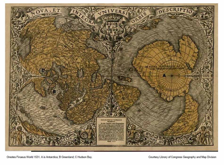
Orestes Finaeus World Map (1531) A is Antarctica, B is Greenland and C is Hudson Bay (Library of Congress)
16th-Century maps of Greenland and Antarctica
Among the maps which can only be reasonably explained as based on surveys of the “ancients” are maps showing Greenland and Antarctica without ice at their coasts. As can be seen from the depiction of Greenland in Mercator’s 1569 World Map, there are free flowing rivers where today glaciers exist. Note that the Independence Fjord area (latitude 82N) on Mercator’s World Map (at the top of the Northeast coast) is very similar to a current map of Independence Fjord. The Orestes Finaeus’ World Map of 1531, while not as detailed, also shows a good representation of Greenland without ice at its coasts.
