


Sculpting The Geological, Archaeological And Cultural Landscape Of Papua New Guinea
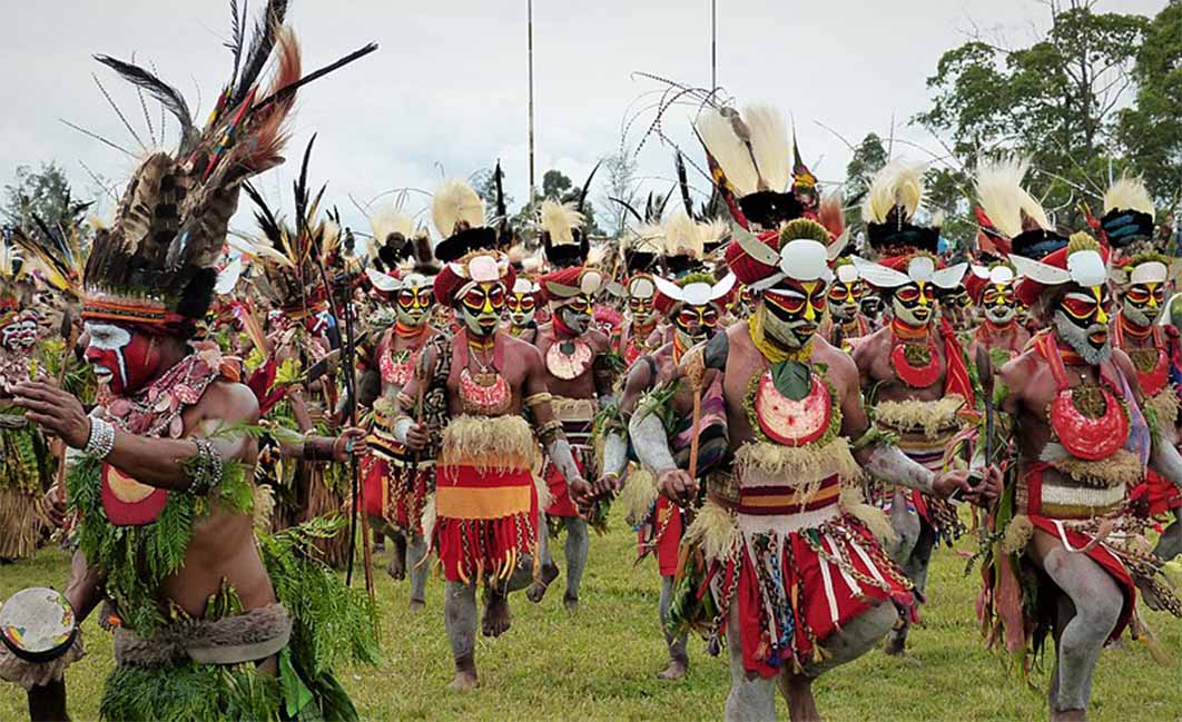
The sculpturing of the geography of Papua New Guinea did not end with the eruption of the volcanos. In their wake basins and valleys formed, where people settled, thousands of years ago. A large inland sea on the north coast of New Guinea, the Sepik-Ramu basin, reached its maximum extent 7,500 to 4,000 years ago. The Bismarck Mountain range slices Papua New Guinea in two creating the western, southern and eastern highlands, crowned by its highest peak, Mount Wilhelm at 4,509 meters (14,793 feet), now an extinct volcano with a crater lake. On the top of the mountains, the landscape is alpine with tundra, in spite of the tropical climate, but on the slopes of the mountain, little villages dot the verdant green vegetation and birds of paradise splash color on the canvas. Legend tells the spirit ancestors sculpted the land as they emerged from the water with each step they took. Following in their footprints, the villagers sculpt crafts, weapons and art, like their forefathers have done thousands of years ago, and sometimes they find these artifacts, bringing tangible proof of their rich history, buried in the volcanic soil of their island.
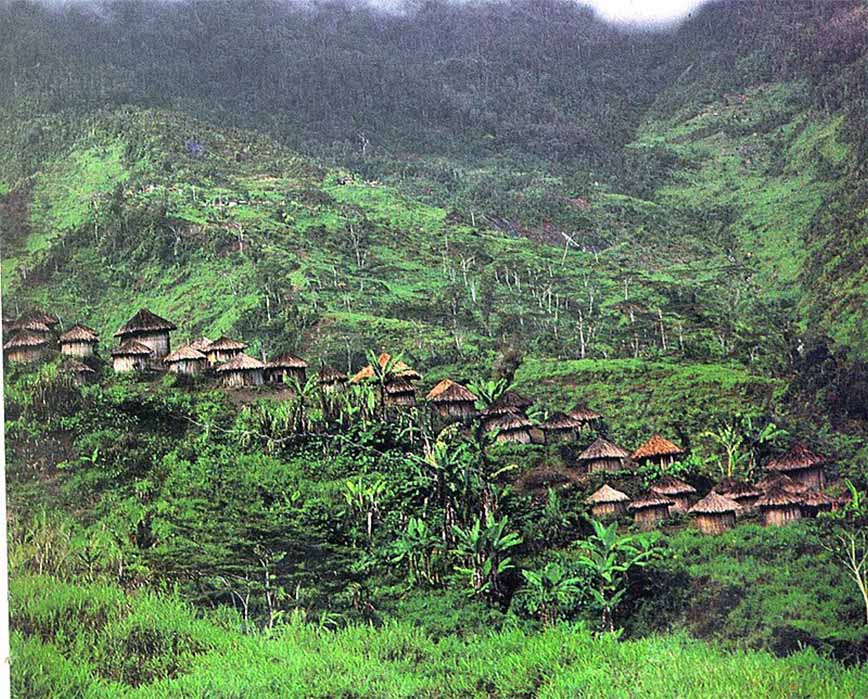
A Highlands village, dotting the verdant mountain slope in Western New Guinea (Frans Huby/ CC BY-SA 3.0)
The capital of the Western Highlands is Mount Hagen, located in the large fertile Wahgi Valley, below the mountain with the extinct volcano located 24 kilometres (15 miles) to the north-west of the town. Life in the town differs greatly from the rural villages and resembles a 1950’s movie set. In contrast, Waim is one of the little rural villages, located 54 kilometers (33 miles) north of the Kuk swamp in the neighboring Wahgi Valley, where the earliest evidence for agriculture has been identified.
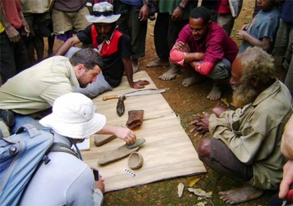
Dr Ben Shaw and some locals examine a few of the Papua New Guinea artifacts unearthed at the Waim dig site. ( UNSW / Ben Shaw)
Evidence Of Palaeo-environments
Wetland agriculture originated in the New Guinea highlands between 8,000 and 4,000 years ago, yet little evidence for corresponding social changes like those that occurred in other parts of the world had been found. Until 2016, when residents of Waim showed Dr Ben Shaw, archaeologist of the University of New South Wales, an unusual artifact they had found of a stone carving of a human face with a bird on top. They led him to the undiscovered archaeological site and after digging one hole, Dr Shaw found a “beautifully shaped stone pestle.” Subsequent archaeological excavations revealed more ground stone pestle fragments with traces of yam, fruit and nut starches on their surfaces, as well as a fire-lighting tool, an ochre-stained rock with cut marks, parts of an axe and an obsidian core, providing the first evidence for long-distance, off-shore obsidian trade, as well as postholes where house posts may have once stood.
The location and pattern of the artifacts at the Waim archaeological site suggest a fixed domestic space and symbolic cultural practices, hinting that the region began to independently develop hallmarks of the Neolithic about 1,000 years before Lapita farmers from Southeast Asia arrived in New Guinea. This ushered in a regional Neolithic Era similar to the Neolithic Period in Eurasia, noted Dr Shaw.
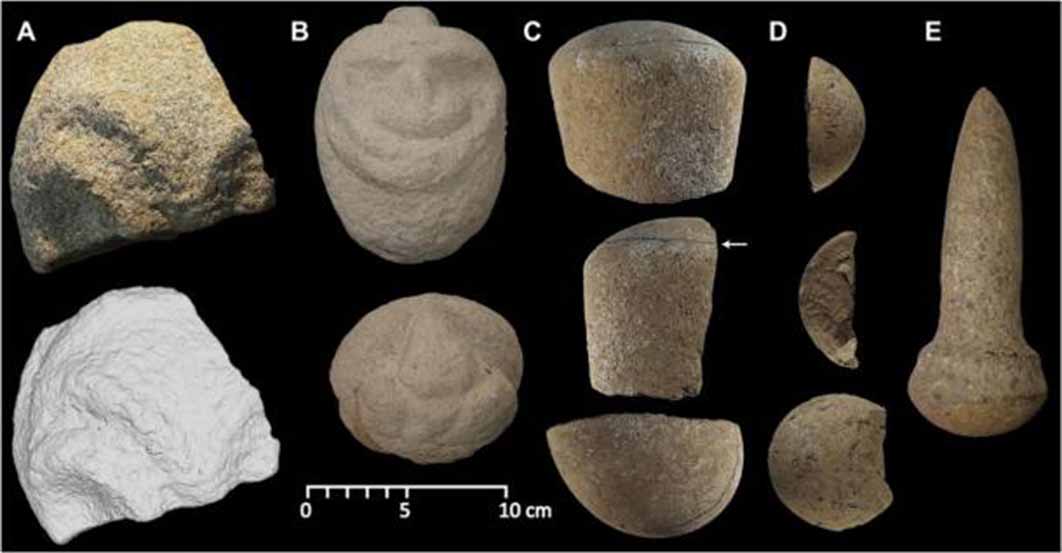
Some of the Papua New Guinea artifacts - formally manufactured stone carvings and pestles from Waim. ( UNSW / Ben Shaw)
