
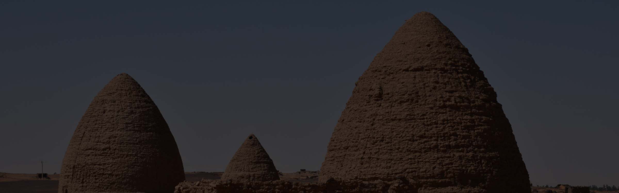


The Three Niles And Cataract Settlements Of Ancient Sudan
On January 1, 1956, after centuries of foreign rule, Sudan finally gained its independence from Great Britain, three years after independence was granted to Egypt on June 18, 1953, and today the borders between the two countries are clearly demarcated on modern maps. However, lines on paper and fenced borders patrolled by armies, do not always divide the people. People naturally converge at water – a source of life – and the Nile Valley holds one of the oldest civilizations on earth, populated by the Nubian people, an ethnic group indigenous to the region, which is now split between northern Sudan and southern Egypt.
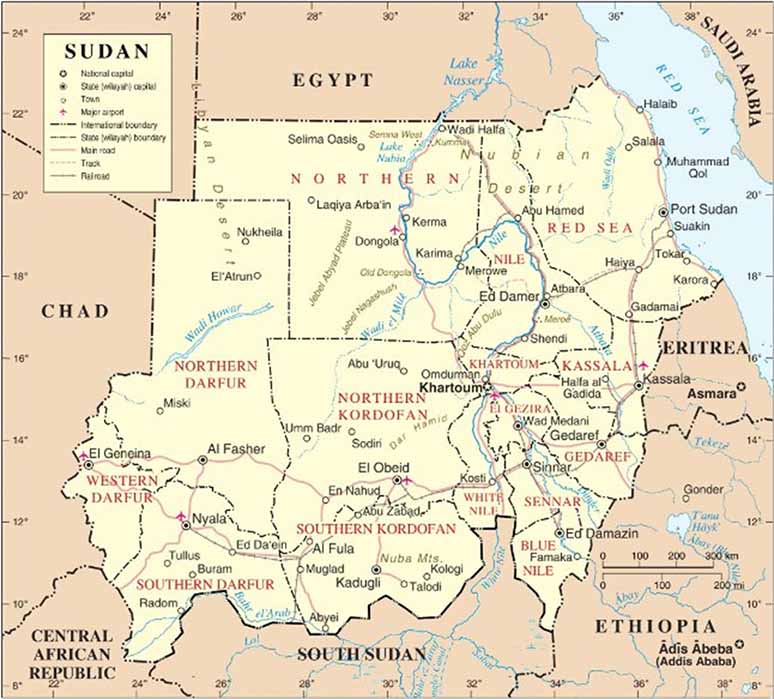
A map of Sudan (Muhammad Daffa Rambe / CC BY-SA 3.0)
The Nubians differ from the Egyptians, but their histories overlap. Robert Bianchi in his 2004-book Daily Life Of The Nubians categorized ancient history in Nubia according to the following periods: A-Group culture (3700–2800 BC) which maintained trade with the Ancient Egyptians in commodities like incense, ebony and ivory. The C-Group culture (2300–1600 BC) arose when Egypt’s Old Kingdom – the Age of the Pyramids – was coming to an end. Speculation exists that the C-group were migrants from the drying Sahara. During Egypt’s Middle Kingdom much of the C-Group lands in Lower Nubia were conquered by Egypt, but regained by the Kerma culture.
The Kerma culture (2500–1500 BC) rivalled Egypt as a civilization and covered a region almost equivalent to that of Egypt, until the rise of the New Kingdom of Egypt (1550–1069 BC) 18th to 20th Dynasties which saw a territorial expansion into Nubia. From the Kerma culture rose the Kingdom of Kush in 1070 BC, following the fragmentation of power in Egypt. Although the Nabateans of Kush also venerated Egyptian gods, and often intermarried Egyptian royalty, they were distinctly different from the Egyptians regarding their material culture and their appearance. Soon the Kingdom of Kush became the rulers of Egypt, establishing the 25th Dynasty (1000 – 653 BC) of the “Black Pharaohs”.
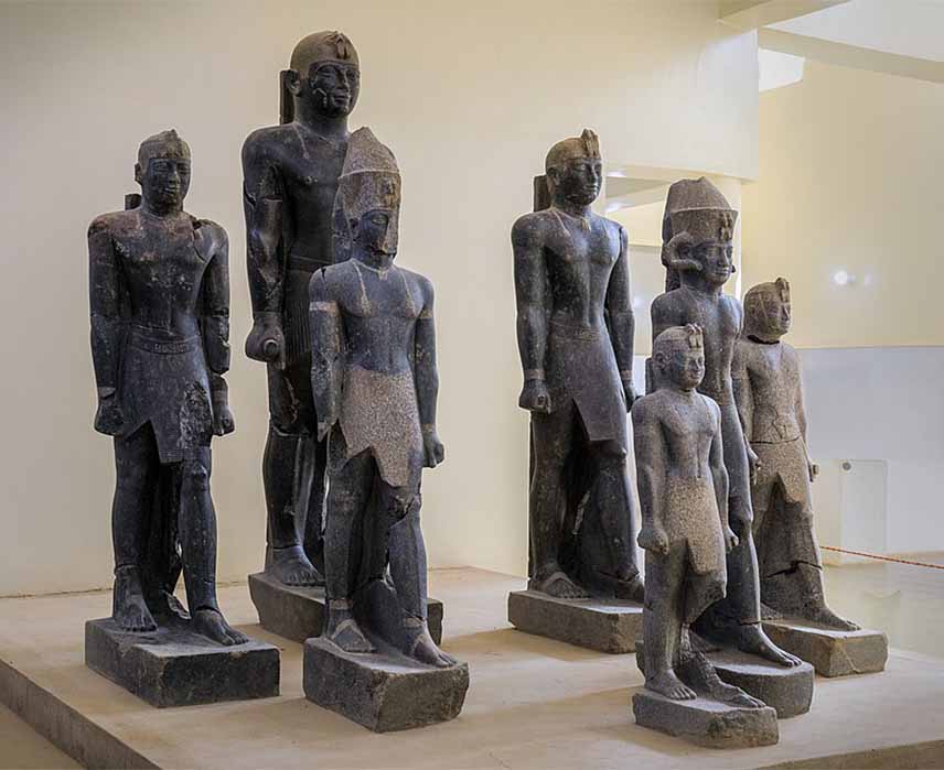
Statues of various rulers of the late 25th Dynasty–early Napatan period. From left to right: Tantamani, Taharqa (rear), Senkamanisken, again Tantamani (rear), Aspelta, Anlamani, again Senkamanisken. Kerma Museum (Matthias Gehricke / CC BY-SA 4.0)
Earlier, in the 15th century BC, Thutmose III had established Napata after his conquest of Kush. The Kings of Kush saw Napata, at the Fourth Cataract, as their spiritual homeland and made it their capital. It was sacked in 593 BC by the Egyptians, when the Kushite capital was relocated to Meroë. From 275 BC royal burials were located at Meroë (275 BC–300/350 AD), where more than 200 pyramids still stand sentinel. Makuria (340–1317 AD) at the Third Cataract was a Christian Kingdom; Nobatia (350–650 AD) to the north of Makuria converted to Coptic Christianity and was annexed by Makuria, and to the south lay Alodia (600s–1504AD ), with its capital Soba, located near modern-day Khartoum at the confluence of the Blue and White Nile rivers.
Nubia: Land Between The Cataracts
Long before human history, Mother Earth enforced a natural border. During the Mesozoic Era, (252 – 66 million years ago) Pangaea was a super-continent, where all the continents were glued together. The name ‘Pangaea’ is derived from Ancient Greek pan, meaning “all, entire, whole” and Gaia or Gaea meaning "Mother Earth". When the tectonic plates moved during this age, cracks formed in the face of Mother Earth and it was the Nubian swell, a geological structural uplift in northern Africa trending east to west, that separated the lower Nile of Egypt from the Sudan basin. The Nile traverses the uplift through geologic fractures and faults.
- Nubia and the Powerful Kingdom of Kush
- Archaeological Marvels Unearthed in Sudan
- The rich history of the ancient Nubian Kingdom of Dongola
Although Egypt and Nubia have a shared pre-dynastic and pharaonic history, the two histories diverge with the fall of Ancient Egypt and the conquest of Egypt by Alexander the Great in 332 BC. At this point, the area of land between the First and the Sixth Cataract of the Nile became known as ‘Nubia’. The word "cataract" comes from the Greek word καταρρέω ("to flow down") referring to rapids in a river and there are six cataracts in the Nile River and four of the six cataracts of the Nile occur at places that the river crosses the uplift. In Ancient Egypt, lower Egypt was delineated from the Nile Delta in the north to the first cataract, cutting through Aswan and forming a natural border to protect Egypt from invasions from the south. The other five cataracts all lie within Sudan. The Second Cataract (or Great Cataract) was in Nubia and is now submerged under Lake Nasser; the Third Cataract is at Tombos/Hannek; the Fourth Cataract is in the Manasir Desert, and since 2008, is submerged under the reservoir of Merowe Dam; the Fifth Cataract is near the confluence of the Nile and Atbarah Rivers and the Sixth Cataract is where the Nile cuts through the Sabaluka pluton, close to Bagrawiyah.

.jpg)